

A line across the Western Desert
Supplied by Peter Veth.
The Canning Stock Route (CSR) follows the traditional waters and crosses the lands of Western Desert peoples who share many social, linguistic, material culture and religious views in common. Some of the tangible expressions of peoples’ long-term occupation, use and enjoyment of these significant deserts are represented by a range of archaeological sites.
These include artefact scatters, grindstone stations, stone arrangements, rock shelters with occupation deposits, quarry sites and contact artefacts such as tools made on historic bottle glass. These sites and features often have contemporary significance to Western Desert peoples being visited and used by them through the time of Alfred Canning’s surveys, the subsequent patrol officers and then other exploration parties as they increasingly entered these lands over the last 100 years.
Desert peoples from the beginning

Research carried out with Western Desert people on their occupation sites along the CSR — from Katjarra (the Carnarvon Ranges) in the south; Jilukurru and Kaalpi (the Durba Hills and Calvert Ranges) in the centre and Parnkupirti (Salt Pan Creek on the edge of Paruku or Lake Gregory) at the north shows that people have occupied the Western Desert for some 50,000 years. Artefacts include flaked stone tools, grindstones, ochre, dietary faunal remains and remnants of old fireplaces. These desert landscapes — thought by many to be ‘marginal’ — have been the homelands for Western Desert people for as long as all other Australian bioregions.
During these 50,000 years, there have been major climate changes: the Last Glacial Maximum (from 30,000 to 18,000 years ago) when conditions were considerably drier, colder and windier than today; and intensification in the El Niño Southern Oscillation (between 4,000 to 2,000 years ago) when the climate was much more volatile. Western Desert people hold that they have always been on their lands — inextricably linked through their Dreamings (jukurrpa).
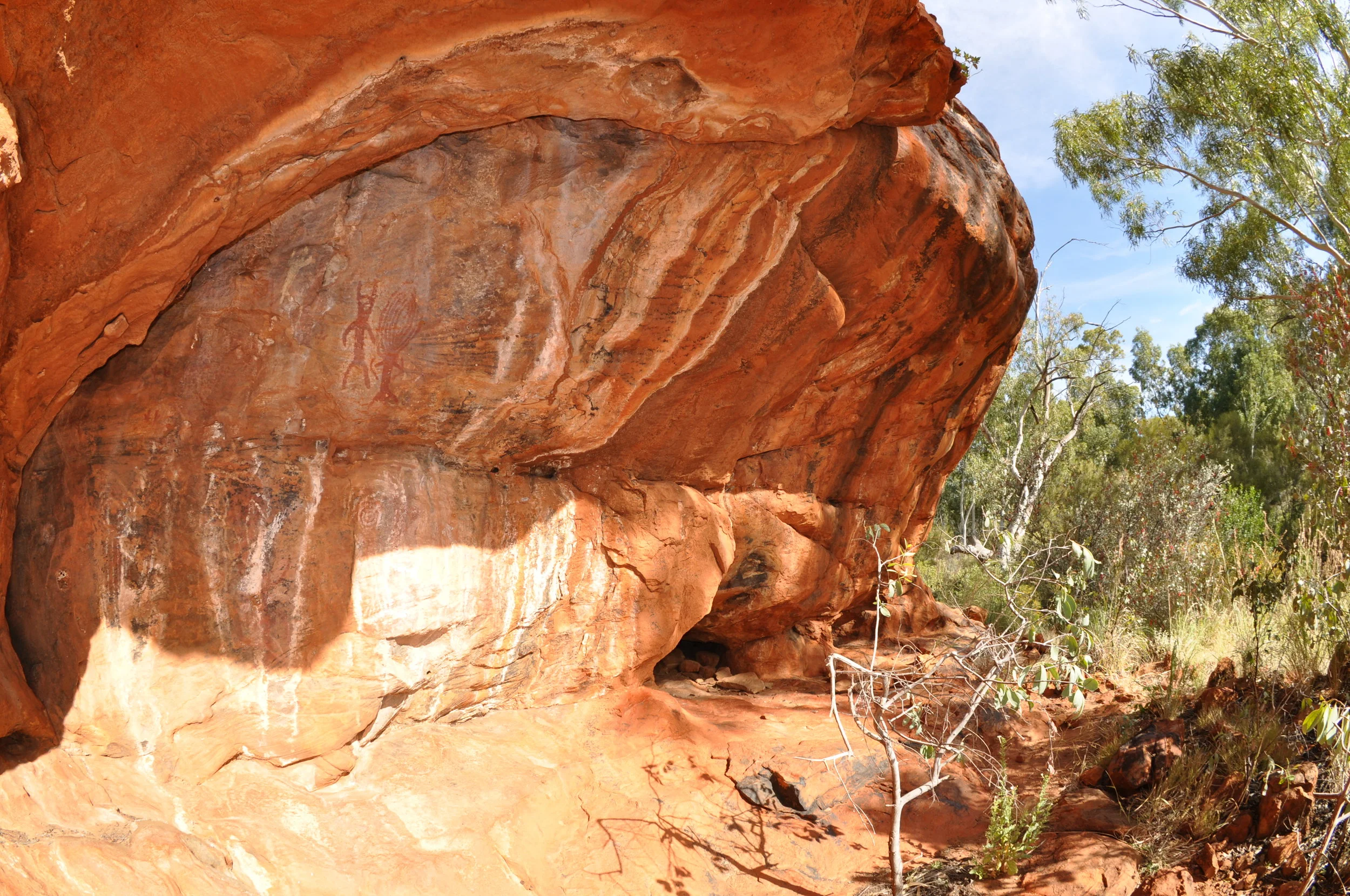
Different sites reflect different economic and social activities

Scatters of flaked and ground stone artefacts occur most often near more reliable water sources (such as springs and rock holes) but are also found on more ephemeral sources such as claypans that are replenished periodically after local rainfall.
These can be special-purpose sites, for example:
where a spear shaft was sharpened
wooden dish fashioned; or
where family groups camped together.
They can vary from just several artefacts up to over one million artefacts in just one location.
Some of the largest sites represent aggregation locales: places where family groups speaking different dialects would come together periodically to hold large gatherings; exchange information; trade and exchange goods and reinforce the social bonds and kinship that link all Western Desert people together.
These occupation sites reflect the pulse and ebb of desert societies where the social imperative to come together in larger groupings is always working within the constraints of the ecological pressure for them to disperse. Social dynamism and flexibility in group composition would have always underwritten desert adaptations.
QUARRY SITES
Quarry sites are special stone outcrops which are ideal for making tools, such as the ‘tula adze’. Tulas are special wood working implements (a little bit like chisels) which start out as robust fashioned tools (on the left-hand side), which are used to adze, chisel and cut in to hardwoods (and other materials) to make important objects like spear throwers, digging sticks, bowls and spears.
They are mounted in spinifex resin to a handle or spear-thrower and are resharpened as they are used over and over again. There are many such wood working tools on the CSR as well as scrapers and a wide range of grinding stones, which were used for processing seeds, plants and even small animals.
Custodianship for future generations
Some of these sites and artefacts are more obvious than others. Stone arrangements and grindstones may be highly visible, while extensive artefact scatters near soaks, springs and claypans may be less so. There are also stone and organic artefacts lying beneath the ground near most water sources and wells on the CSR. Some very old boomerangs were unearthed by 4WD traffic at Kartaru (Well 24) in 2008. Your help in minimising impact on this heritage is needed.
As these sites and artefacts are an irreplaceable record of peoples’ use of these lands, it is not permitted to remove them (under state and federal heritage legislation). It is also a good idea to think about where you are going to camp. Minimising ground disturbance and not raking up areas — as this will always affect these sites which may be many thousands of years old — are additional ways that you can help look after country.
The lands are literally ‘alive’ with Dreamings, historic connections and numerous tangible materials such as the occupation sites, objects and artefacts — just some of which have been described here.
